Eternal Himalayan Ice Reservoirs

Glaciers in Uttarakhand

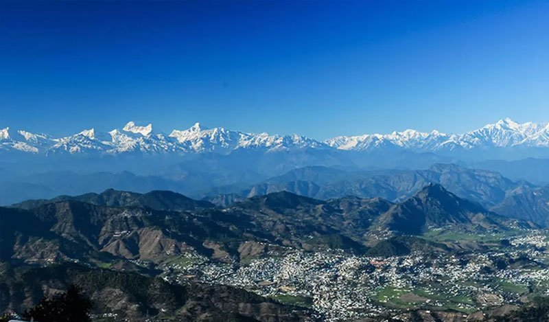
Journey to the colossal frozen sanctuaries of the Greater Himalayas — the sacred origins of the Ganges, Yamuna, Alaknanda, and Pindar rivers, and world-class trekking frontiers.

900+ Himalayan Glaciers
Sacred Ganga Source (Gaumukh)
Legendary Glacier Treks
Inner-Line & Forest Permits
Geological Wonder

The Frozen Lifelines of Northern India

Uttarakhand’s high crests house over 900 glaciers that act as gigantic freshwater towers, nourishing hundreds of millions across the Indian subcontinent.

Glacial Anatomy

Where Eternal Ice Meets Sacred Lore

Perched at altitudes ranging from 3,500 meters to well over 6,000 meters, Uttarakhand's glaciers are dynamic rivers of ice moving slowly through ancient carved U-shaped valleys. The snout of Gangotri Glacier at Gaumukh has drawn pilgrims and ascetics for thousands of years as the revered cradle of the River Bhagirathi.

In Kumaon, the magnificent amphitheater of Pindari Glacier and the border wilderness of Milam Glacier provide world-renowned trekking routes under the colossal shadows of Nanda Devi (7,816 m), Trishul (7,120 m), and Hardeol.

Gangotri Glacier Snout Gaumukh
Glacier Directory

Major Glaciers & Trekking Expeditions

Explore the elevation, river connection, difficulty, and trekking logistics of the state's most prominent glaciers.

Gangotri Glacier Gaumukh
Uttarkashi · Garhwal Himalayas

Gangotri Glacier (Gaumukh)

Snout Elevation: 3,920 m (12,860 ft) | Length: 30 km
River Fed: Bhagirathi (Primary holy source of Ganga)
Trek Distance: 18 km from Gangotri town via Chirbasa & Bhojbasa
Grade: Moderate-Difficult
Highlights: The snout resembles a cow's mouth; trail continues to high alpine Tapovan meadow under Mt. Shivling.
Pindari Glacier Zero Point
Bageshwar · Kumaon Himalayas

Pindari Glacier

Snout Elevation: 3,660 m (Zero Point) | Length: 3.2 km
River Fed: Pindar River (meets Alaknanda at Karnaprayag)
Trek Distance: ~45 km round trip from Song / Loharkhet base
Grade: Beginner Friendly
Highlights: Welcoming Kumaoni hamlets, rhododendron cloud forests, and comfortable KMVN tourist rest houses.
Milam Glacier Johar Valley
Munsiyari · Pithoragarh District

Milam Glacier

Snout Elevation: 4,267 m (14,000 ft) | Length: 16 km
River Fed: Goriganga River
Trek Distance: ~60 km round trip from Munsiyari
Grade: Difficult / Long Trek
Highlights: Ancient Indo-Tibetan salt trade route, abandoned Shauka stone villages, and Mt. Trishuli panoramas.
Satopanth Glacier Chaukhamba
Mana Village · Chamoli District

Satopanth & Bhagirath Kharak

Elevation: 4,600 m – 5,200 m (17,000 ft)
River Fed: Alaknanda River
Trek Distance: 25 km one way past Vasudhara Falls
Grade: Strenuous Alpine
Highlights: Northern slopes of Mt. Chaukhamba; crystal-clear triangular Satopanth Tal revered in Hindu epic Mahabharata.
Khatling Glacier Tehri Garhwal
Ghuttu · Tehri Garhwal District

Khatling Glacier

Elevation: 3,700 m – 4,200 m
River Fed: Bhilangana River (Tehri Lake source)
Trek Base: Ghuttu Village
Grade: Challenging Wilderness
Highlights: Rugged lateral moraines surrounded by Jogin group and Barte Kauter peaks; leads to pristine Masar Tal.
Kafni Glacier Nandakot
Bageshwar District · Kumaon

Kafni Glacier

Snout Elevation: 3,860 m (12,664 ft)
River Fed: Kafni River
Trek Base: Khati Village (fork off Pindari trail)
Grade: Moderate
Highlights: Sits serenely beneath Nandakot peak; broad alpine meadows, colorful Himalayan monal sightings, fewer tourists.
Quick Comparison

Glacier Profile & River Matrix

Key statistics, river connections, and trek difficulty ratings for Uttarakhand's major glaciated regions.

Glacier Name District & Region Snout Altitude River Fed Trek Difficulty Best Visiting Season
Gangotri (Gaumukh) Uttarkashi (Garhwal) 3,920 m Bhagirathi (Holy Ganga) Moderate-Difficult May – June, Sep – Oct
Pindari Glacier Bageshwar (Kumaon) 3,660 m Pindar (Alaknanda tributary) Beginner Friendly April – June, Sep – Nov
Milam Glacier Pithoragarh (Kumaon) 4,267 m Goriganga Difficult May – June, Sep – Oct
Satopanth Glacier Chamoli (Garhwal) 4,600 m Alaknanda River Strenuous Alpine June, Sep – Oct
Khatling Glacier Tehri Garhwal 3,700 m Bhilangana River Challenging June, Sep – Oct
Kafni Glacier Bageshwar (Kumaon) 3,860 m Kafni River Moderate May – June, Sep – Oct
Expedition Logistics

Trek Permits & Season Guidelines

Mandatory government clearances, daily quotas, and optimal weather windows for high-altitude glacier journeys.

National Park Permits

The Forest Department enforces a strict ceiling of 150 visitors per day to Gaumukh inside Gangotri National Park. Permits must be secured online in advance via the Uttarakhand single-window portal or registered at Uttarkashi DFO office.

Inner-Line Clearances

Glaciers near the Tibetan border (such as Milam, Ralam, and Darma valleys in Pithoragarh) require Inner Line Permits issued by the Sub-Divisional Magistrate (SDM) in Dharchula or Munsiyari with valid government photo ID.

Optimal Trek Seasons

Pre-Monsoon (May to June): Alpine meadows bloom, snow bridges remain intact for stream crossings.
Post-Monsoon (September to October): Crystal-clear atmospheric visibility and sharp mountain alpenglow.

Life Safety

High Altitude Glacier Trekking Protocol

Glacial environments present unpredictable hazards including crevasses, terminal moraine rockfall, and acute hypoxia.

Acclimatization & AMS

Above 3,000 meters, atmospheric pressure drops significantly. Ascend gradually (no more than 500 m altitude gain per day). Stay hydrated with 4 liters of water daily, monitor pulse oximeter readings, and carry Diamox under medical advice.

Certified Guides Only

Never attempt glacier moraine crossings solo. Employ licensed guides certified by Nehru Institute of Mountaineering (NIM) or the Indian Mountaineering Foundation (IMF). Dynamic ice crevasses can be fatally masked by fresh snow.

Leave No Trace Principle

Himalayan glaciers are retreating rapidly due to global climate change. All non-biodegradable waste, wrappers, and plastic containers must be packed out to base settlements. Open defecation near glacial melt streams is strictly prohibited.

Common Questions

Frequently Asked Questions

Essential advice for travelers planning high-altitude glacier expeditions in Uttarakhand.

Gangotri Glacier is the largest glacier in Uttarakhand, stretching over 30 kilometers in length and up to 4 kilometers in width in Uttarkashi district. Its snout at Gaumukh (3,920 m) is the primary hydrological and spiritual origin of River Bhagirathi (Ganga).

Pindari Glacier trek in the Kumaon Himalayas (Bageshwar district) is celebrated as the most accessible and beginner-friendly glacier trek in Uttarakhand, with well-marked trails, KMVN rest houses, and gentle elevation gains to Zero Point (3,660 m).

Yes, permits are mandatory for most high-altitude glaciers. For example, Gaumukh requires Gangotri National Park permits (restricted to 150 visitors/day), while Milam Glacier requires Inner Line Permits (SDM office) due to border proximity.

High Himalayan Expeditions

Ready to Witness the Eternal Glaciers of Devbhoomi?

Explore comprehensive trail maps, certified local mountain guides, packing lists, and permit registration portals.

All Uttarakhand Treks Tourist Circuit Maps