The Sacred Land of Gods & Glaciers

Garhwal Region

The spiritual and mountaineering heart of Uttarakhand. Home to the holy Char Dham shrines, the sacred Ganga origin, the mighty peaks of Nanda Devi and Kamet, ski slopes of Auli, and legendary Himalayan trekking trails.

7 Mountain Districts
Char Dham Shrines
Sacred Panch Prayags
Auli Ski Resort
30+ Alpine Treks
Geographical & Historical Soul

The Majesty of Garhwal

Garhwal—meaning the "Land of Fortresses"—historically comprised 52 independent chieftainships (garhs) unified in the 14th century by King Ajay Pal of the Panwar dynasty.

The Epicenter of Devbhumi

Where Rivers are Born and Faith Touches the Sky

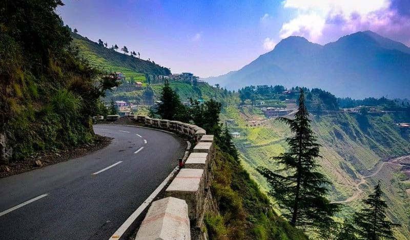
Stretching from the Shivalik foothills at Haridwar to the towering glaciated wall of the Greater Himalayas along the Tibetan frontier, Garhwal is the geological birthplace of India's two holiest rivers: the Ganga (originating as the Bhagirathi from Gaumukh glacier) and the Yamuna (originating from Yamunotri glacier).

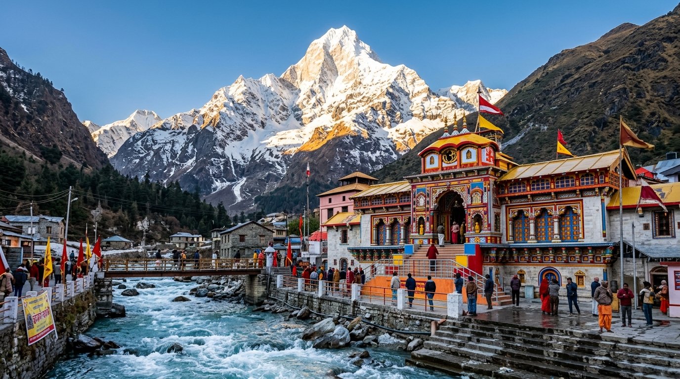
It hosts India’s highest mountain entirely within national borders—Nanda Devi (7,816 m)—along with celebrated summits like Kamet (7,756 m), Chaukhamba (7,138 m), Trishul (7,120 m), Shivling (6,543 m), and Neelkanth. For centuries, sages, ascetics, kings, and mountaineers have journeyed to Garhwal to seek liberation, transcendence, and alpine glory.

Garhwal Himalayas Panorama
Administrative Directory

The 7 Districts of Garhwal

Each district in Garhwal possesses its own distinct landscape, spiritual sanctuaries, and alpine character.

Dehradun District
District HQ: Dehradun

Dehradun

Altitude: 640 m – 2,250 m
Key Highlights: Mussoorie Queen of Hills, Robber's Cave, Sahastradhara, Chakrata Tiger Falls, Rajaji National Park.
Transit Hub: Jolly Grant Airport (DED) & Dehradun Terminal (DDN).
Haridwar District
District HQ: Haridwar

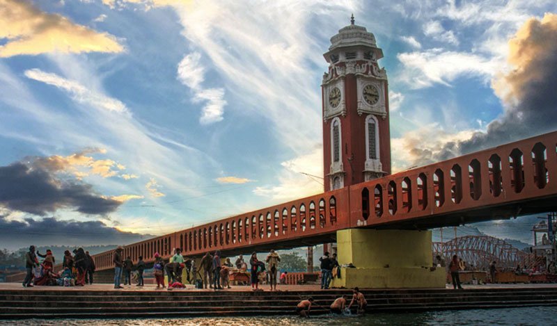
Haridwar

Altitude: 314 m
Key Highlights: Har Ki Pauri Ganga Aarti, Mansa Devi & Chandi Devi temples, Kumbh Mela grounds, Shantikunj.
Transit Hub: Haridwar Junction (HW) – Gateway to Char Dham.
Chamoli District
District HQ: Gopeshwar

Chamoli

Altitude: 1,300 m – 7,816 m (Nanda Devi)
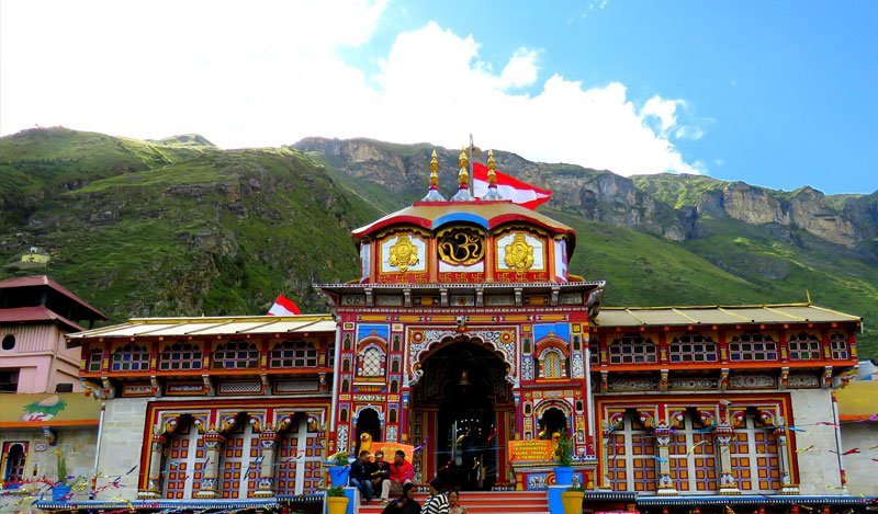
Key Highlights: Badrinath Dham, Auli Ski Slopes, Valley of Flowers, Hemkund Sahib, Mana (First Indian Village).
Role: Largest district in Uttarakhand; spiritual & winter sports epicenter.
Rudraprayag District
District HQ: Rudraprayag

Rudraprayag

Altitude: 895 m – 3,850 m
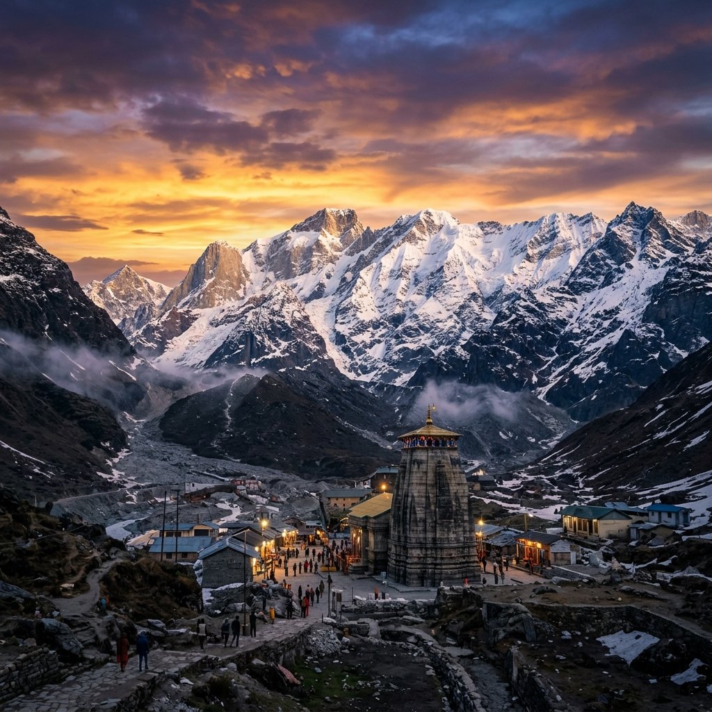
Key Highlights: Kedarnath Jyotirlinga, Chopta (Mini Switzerland), Tungnath (Highest Shiva Shrine), Deoria Tal, Madhyamaheshwar.
Role: Sacred Alaknanda-Mandakini sangam; Shiva heartland.
Uttarkashi District
District HQ: Uttarkashi

Uttarkashi

Altitude: 1,158 m – 6,500 m
Key Highlights: Gangotri Dham, Yamunotri Dham, Gaumukh Glacier, Har Ki Dun Valley, Dayara Bugyal, Harsil Apple Valley.
Role: Cradle of the two sacred river origins; premier trekking capital.
Tehri Garhwal District
District HQ: New Tehri

Tehri Garhwal

Altitude: 1,550 m – 2,800 m
Key Highlights: Tehri Dam Lake & Water Sports, Dhanaulti Eco Park, Kanatal, Surkanda Devi Temple, Chamba.
Role: Adventure water reservoir and tranquil pine ridges.
Pauri Garhwal District
District HQ: Pauri

Pauri Garhwal

Altitude: 1,650 m – 2,200 m
Key Highlights: Lansdowne Cantonment, Khirsu Pine Woods, Dhari Devi Guardian Temple, Kandoliya Shiva Temple, Srinagar Garhwal.
Role: Historic royal center and peaceful colonial cantonment.
Pilgrimage Circuits

The Spiritual Heart of India

Garhwal is globally revered for the most sacred and transformative pilgrimage circuits in Sanatana Dharma.

Badrinath Dham Garhwal

The Sacred Char Dham

The holy quadrant of Yamunotri, Gangotri, Kedarnath, and Badrinath. Visited in a clockwise parikrama between May and November, purifying the soul at heights above 3,000 meters.

Panch Prayag Confluences

The Sacred Panch Prayags

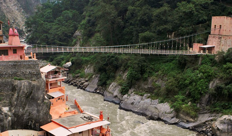
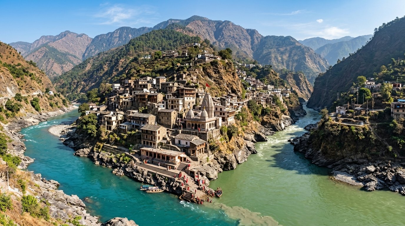
Five divine confluences forming Mother Ganga: Vishnuprayag (Dhauliganga), Nandaprayag (Nandakini), Karnaprayag (Pindar), Rudraprayag (Mandakini), and Devprayag (Bhagirathi).

Kedarnath Panch Kedar

The Sacred Panch Kedar

The five manifestations of Lord Shiva worshiped by the Pandavas: Kedarnath (Hump), Madhyamaheshwar (Navel), Tungnath (Arms), Rudranath (Face), and Kalpeshwar (Hair).

Full Char Dham Yatra Guide Full Panch Kedar Guide
Alpine Expeditions

Adventure & Mountaineering in Garhwal

From the roaring white-water rapids of Rishikesh to the powder snow of Auli and high-altitude glacial pass crossings.

Auli Ski Slopes Chamoli

Skiing at Auli

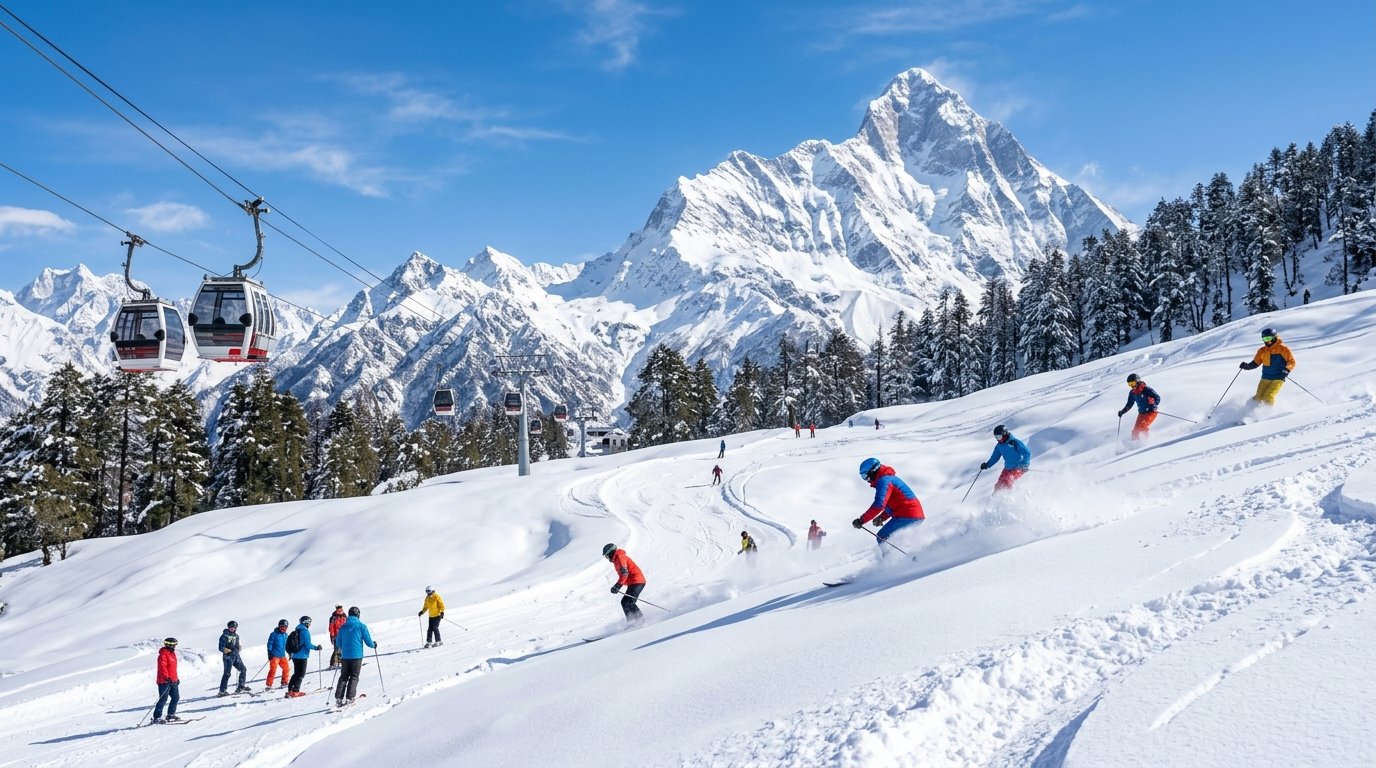
India’s premier winter ski capital situated at 3,050 meters with professional ski slopes, French-designed chairlifts, and majestic panoramic views of Mount Nanda Devi.

Rishikesh River Rafting

White-Water Rafting in Rishikesh

The Yoga and Adventure Capital of the World. Navigate adrenaline-charged Grade III & IV rapids along the Ganga (Shivpuri, Marine Drive, Kaudiyala) from October to June.

Valley of Flowers National Park

Iconic Himalayan Treks

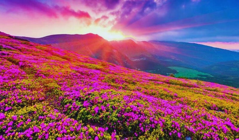
Trailheads leading to Har Ki Dun, Kuari Pass, Chopta Chandrashila, Dayara Bugyal, Kedarkantha snow trek, and the UNESCO Valley of Flowers.

Explore 53 Garhwal & Uttarakhand Treks
Summer Escapes

Charming Hill Stations of Garhwal

Colonial heritage, pine-scented air, and panoramic Himalayan viewpoints.

Mussoorie Queen of Hills

Mussoorie – Queen of Hills

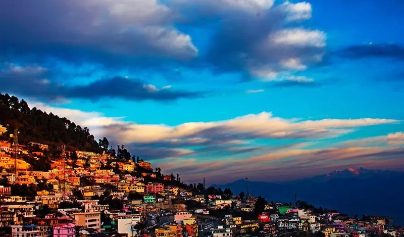
Perched on a ridge at 2,000 meters overlooking the Doon Valley. Famous for the Mall Road, Kempty Falls, Gun Hill, Landour cantonment, and the winterline phenomenon.

Lansdowne Cantonment Pauri

Lansdowne – Peaceful Cantonment

An unspoiled military cantonment of the Garhwal Rifles founded in 1887. Characterized by serene church steeples, Bhulla Tal lake, Tip-in-Top, and zero commercial noise.

Dhanaulti Pine Forests

Dhanaulti & Kanatal

Nestled amongst dense deodar forests between Mussoorie and Chamba. High-altitude retreats offering peaceful eco-parks, adventure camping, and heavy winter snowfall.

Heritage & Flavors

Garhwali Culture, Folk Traditions & Cuisine

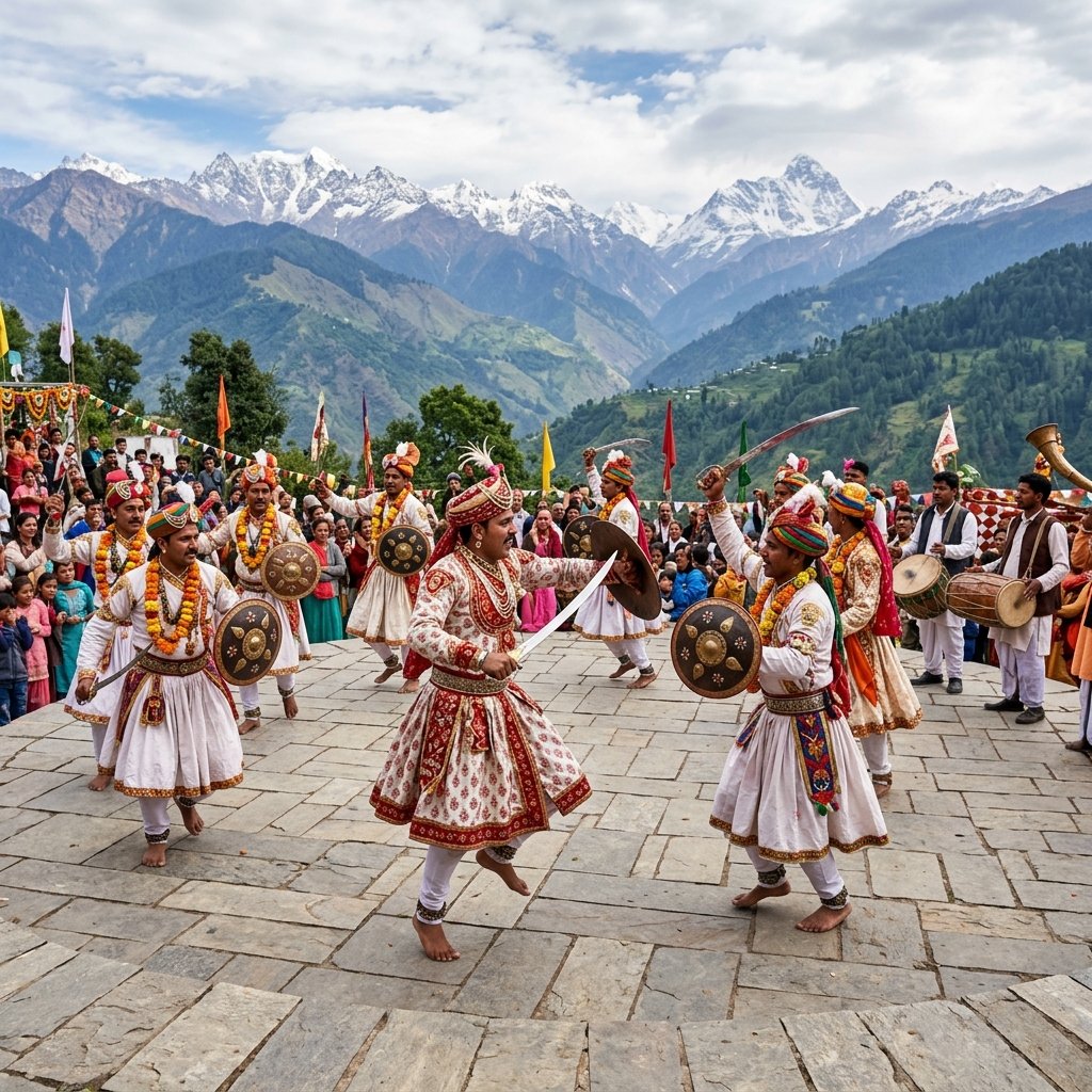
The people of Garhwal, known as Garhwalis, possess a deep spiritual reverence for the Himalayas and local guardian deities (such as Dhari Devi and Nanda Devi). Their cultural heritage comes alive in the ancient Pandav Nritya dance enacting the Mahabharata, the rhythmic beats of the Dhol-Damau folk percussion, and vibrant fairs like the Tapkeshwar Mela and Bikhoti.

Authentic Garhwali Gastronomy: Designed to provide wholesome energy in high-altitude cold climates:

  • Kafuli: A thick, nutrient-rich spinach and fenugreek gravy prepared in an iron kadhai and tempered with jakhiya seeds.
  • Chainsoo: Roasted black gram (urad dal) paste simmered slowly into a hearty, smoky curry.
  • Phaanu: A delicate, protein-dense stew made from a combination of mountain lentils.
  • Aloo ke Gutke with Jakhiya: Boiled mountain potatoes stir-fried with wild Himalayan cleome seeds (jakhiya).
  • Jhangore ki Kheer: A divine dessert crafted from barnyard millet, slow-cooked in rich mountain buffalo milk with cardamom and nuts.
Garhwali Folk Traditions & Culture
Transport Connectivity

How to Reach the Garhwal Region

Garhwal enjoys the most modern transportation infrastructure in Uttarakhand:

  • By Flight: Jolly Grant Airport, Dehradun (DED) is located in Garhwal with nonstop flights from Delhi (45 mins), Mumbai, Bengaluru, Ahmedabad, and Hyderabad.
  • By Train: Haridwar Junction (HW), Dehradun (DDN), and Yog Nagari Rishikesh (YNRK) broad-gauge terminals receive direct daily trains including the 4h 45m Vande Bharat Express from Delhi.
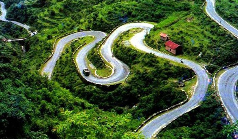
  • By Expressway & Road: The new Delhi-Dehradun Expressway cuts drive time to just 2.5 to 3 hours, while NH 7 / NH 107 provide paved connectivity across the Char Dham corridors.
Devprayag Sangam Garhwal Highway
Frequently Asked Questions

Frequently Asked Questions: Garhwal

Common queries regarding travel, permits, seasons, and itineraries in the Garhwal division.

The best time depends on your travel intent: May to June is ideal for pleasant hill station weather and the Char Dham Yatra. September to November offers crystal-clear Himalayan views and the finest high-altitude trekking conditions. December to February is perfect for experiencing heavy snowfall and skiing in Auli.

Chamoli is the largest district in Garhwal (and all of Uttarakhand), spanning 8,030 square kilometers and containing the highest Himalayan peaks, Badrinath Dham, and the Valley of Flowers.

Most tourist destinations in Garhwal (Dehradun, Mussoorie, Rishikesh, Haridwar, Badrinath, Kedarnath, Auli) are open to foreign nationals with a standard Indian tourist visa. Only sensitive border areas near the Tibetan frontier (such as Niti Valley in Chamoli or Nelang Valley in Uttarkashi) require an Inner Line Permit (ILP) issued by the District Magistrate.

The Panch Prayags are five sacred river confluences along the Alaknanda River: Vishnuprayag, Nandaprayag, Karnaprayag, Rudraprayag, and Devprayag. Devprayag is where the Alaknanda and Bhagirathi meet to officially form the holy River Ganga.

Plan Your Garhwal Himalayan Journey

Ready to experience the divine Char Dham temples, ski the powder snow of Auli, or trek to glacial valleys? Connect with our Garhwal mountain specialists on WhatsApp.

Send Enquiry