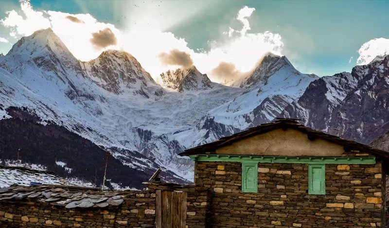
Beyond the standard road network of Uttarakhand lies an extreme frontier—a world of stark rain-shadow canyons, ancient wooden cliffwalks built by Tibetan salt traders, and sacred valleys accessible only with official Inner Line Permits from District Magistrates and the Indo-Tibetan Border Police (ITBP).
These are Uttarakhand’s "Ultra-Offbeat" sanctuaries: places like Nelang Valley (frequently termed the Ladakh of Uttarakhand), the mystical Niti Valley bordering Tibet, the dramatic glacial gorges of Darma Valley, and the legendary cave of Mahavatar Babaji in Dunagiri. Here is your definitive frontier travel guide for 2026.
1. Inner Line Permits & Border Zone Guidelines
Mandatory Border Permits
Because valleys like Nelang, Niti, and higher Darma lie adjacent to the Line of Actual Control (LAC) with Tibet/China, Indian travelers must obtain an Inner Line Permit (ILP) from the Sub-Divisional Magistrate (SDM) or District Magistrate offices in Uttarkashi, Joshimath, or Dharchula. Foreign nationals are generally restricted from certain inner border zones.
| Frontier Valley | District | Elevation | Permit Required? | Defining Feature |
|---|---|---|---|---|
| Nelang Valley | Uttarkashi | 3,500 m | Yes (SDM Uttarkashi) | Cold desert canyon resembling Ladakh; historic wooden Gartang Gali cliff bridge |
| Niti Valley | Chamoli | 3,600 m | Yes (SDM Joshimath) | Ancient Bhotia border villages, Dronagiri mountain & Timarsain ice lingam cave |
| Darma Valley | Pithoragarh | 3,450 m | Yes (SDM Dharchula) | Closest raw viewpoint of the Panchachuli peaks, Bhotia homestays & glacial rivers |
| Mahavatar Babaji Cave | Almora / Dwarahat | 2,150 m | No permit needed | Birthplace of Kriya Yoga (Autobiography of a Yogi) hidden in Kukuchina woods |
| Chongring & Milam Trail | Pithoragarh | 3,870 m | Yes (SDM Munsiyari) | Historic salt trade route to Tibet across rugged Goriganga river gorges |
| Mana Pass & Deotal | Chamoli | 5,632 m | Army & ITBP permit | One of the highest motorable passes on Earth, sacred origin of Saraswati river |
Nelang Valley & Gartang Gali – The Ladakh of Garhwal
Located inside Gangotri National Park, Nelang is a stark, high-altitude arid valley featuring windswept rocky canyons and Tibetan wildlife like snow leopards and Bharal (blue sheep). The valley preserves Gartang Gali, a thrilling 150-year-old wooden cantilever bridge clung to a vertical 300-meter cliff.
Explore Gangotri National ParkDarma Valley – The Shadow of Panchachuli
Stretching towards the Sino-Tibetan border from Dharchula along the Dhauli Ganga river, Darma Valley passes through 14 ancient Bhotia villages like Dugtu and Dantu, offering staggering up-close views of the Panchachuli glacier.
Explore Dharchula & ValleysMahavatar Babaji’s Cave – Cradle of Kriya Yoga
Hidden in the Pandukholi hills of Kukuchina near Dwarahat, this is the sacred cave where Mahavatar Babaji initiated Lahiri Mahasaya into the ancient science of Kriya Yoga in 1861, immortalized in Paramahansa Yogananda's spiritual classic.
Explore Dwarahat & DunagiriFrequently Asked Questions (FAQs)
Permits for Nelang Valley must be requested from the Sub-Divisional Magistrate (SDM) office in Uttarkashi with government photo ID and vehicle registration details. A forest entry fee for Gangotri National Park must also be paid at the Bhaironghati checkpost.
The road from Dharchula to Dugtu/Dantu has been substantially improved by the Border Roads Organisation (BRO), but high-ground-clearance vehicles (SUVs, 4x4s, Boleros) are strongly recommended due to stream crossings and rocky sections.
Drive to Dwarahat in Almora district, continue 20 km to Kukuchina, and embark on a 2 km steep uphill forest hike through pine and oak woods to the cave entrance.